
An Expedition into the Culture of Tohoku and the Sanriku Coast: A Walking Tour via the Michinoku Coastal Trail
Sanriku Coast is the shoreline that stretches from Hachinohe City in Aomori Prefecture to Ishinomaki City in Miyagi Prefecture. While the region saw tremendous damage after the tsunami triggered by the Great East Japan Earthquake in March 2011, the abundant mountains and sea have continued to nurture the lives and distinct culture of those who live here since ancient times. Take to the Michinoku Coastal Trail, a new path built after tragedy, and step into a world of robust food culture and remarkable folk arts that are shaped by the landscapes tucked between forest and sea.
What is the Michinoku Coastal Trail?
The Michinoku Coastal Trail is a “trail to take by foot”, stretching over 1,000 km from Kabushima in Hachinohe City, Aomori Prefecture to Matsukawa-ura Environmental Park in Soma City, Fukushima Prefecture. The pathway opened as a new road towards recovery after the Great East Japan Earthquake, completed in 2019 thanks to the collective efforts of the Ministry of the Environment, 29 municipalities across 4 prefectures, private organizations, and ardent local residents. The very emphasis on keeping a walking pace serves as a hint to the subtle discoveries and precious, nuanced encounters that await at Tohoku’s newest tourist destination.
Video of A Walking Tour via the Michinoku Coastal Trail
How to Get to the Michinoku Coastal Trail?
While the entire trail can be completed in about 50 days by walking 20 km per day, this modular walk is made for you to choose your own adventure, selecting a part based on your personal endurance level and experience. For convenient access to the northernmost start/end point in Hachinohe City, the Tohoku Shinkansen bullet train is recommended. From Tokyo Station, you can reach JR Hachinohe Station in as little as approximately 2 hours and 45 minutes. In this article you’ll find several model plans to bring you the best highlights available to see via public transportation.
Table of Contents
- Plan 1: Savor Fine Wine and Stunning Scenery – a Recommended Hachinohe Route for Trail Beginners
- The entire island is a natural monument.
- The blessings brought by the Yamase winds.
- Take a Short Break at the Observatory
- Take in the ever-changing scenery.
- Recommended Pre-Night Stay If Walking the Hachinohe City Route!
- Wake up early the next day and head to the area around JR Mutsu-Minato station.
- Plan 2: Learn the traditions of the land living with the sea – Fudai Village to Tano-Hata Village Route
- Plan 3: Revel in the Local Arts Nurtured by the Forest and Sea: Miyako to Otsuchi Route
- Conclusion


Plan 1: Savor Fine Wine and Stunning Scenery – A Recommended Hachinohe Route for Trail Beginners
(Overnight + 1 Day)
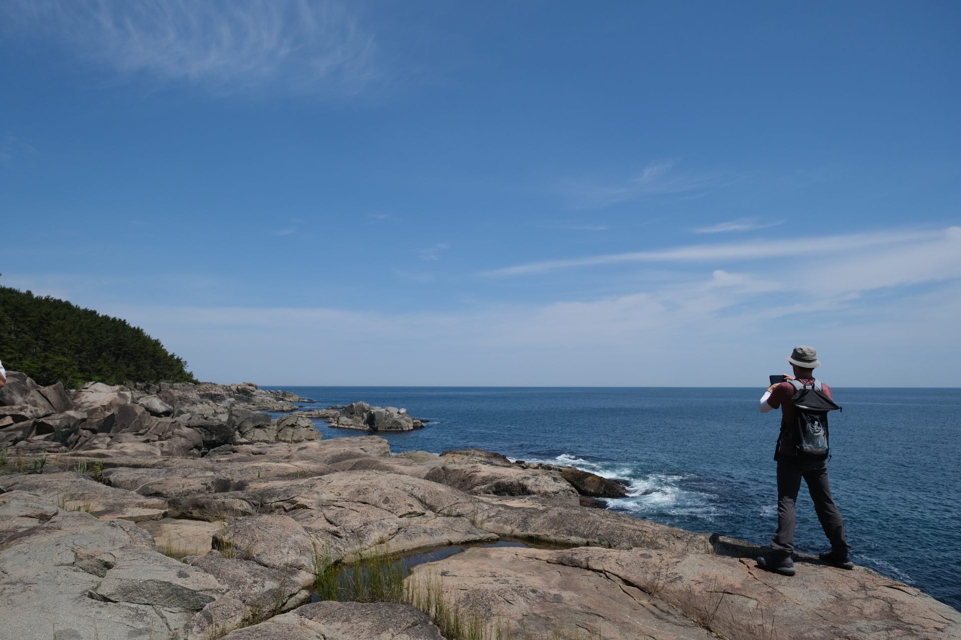
The 9-km route from Kabushima, the start/end point of the Michinoku Shiokaze Trail, to Tanesashi Coast offers gentle ups and downs, making it a popular course for first-time takers to the trail. Here you’ll find the ever-changing scenery of rocky areas, meadows, sandy beaches, pine forests, and grasslands. Your journey will start with a quick prayer for safe travels at the long-revered local Kabushima Shrine before kicking off into a full immersion of authentic coastal lifestyle.
From Hachinohe Station, it's a 25-minute ride on the JR Hachinohe Line to the nearest Same station.

The entire island is a natural monument.
Kabushima is a spot like none other, where visitors can see Black-tailed gull nests and the rearing of their young at close proximity. Kabushima Shrine, situated at the top, enshrines Benzaiten as a guardian deity for prosperous business and fishing safety. These gulls are believed to be messengers of Benzaiten and have been long cherished in the region for ages.
After a fire in 2015, the shrine was rebuilt using donations from across Japan. The shrine's foundation and ornamental beams are made of moisture-resistant Aomori cypress. The attic beams are made of Southern pine, and the shrine's fences and water basin are made of Aomori-produced chestnut wood.


The blessings brought by the Yamase winds.
After paying respects at the Kabushima Shrine and passing the rocky areas near the fishing port, you'll make your way into a walk through the coastal meadow. This area's unique vegetation, with over 650 species of coastal and alpine plants, sprouts due to the region's unique climate, influenced by mild winters and the cool and moist summer winds called "Yamase".
Historically, this region struggled with cold damage brought on by Yamase, meaning staple crops like rice and cotton were hard to grow. This natural occurrence led instead to the birth of vibrant flower fields and cultivated a rich cultural heritage, like Nanbu Split Weaving, Nanbu Diamond Stitching, and the traditional folk performance art known as Enburi.


Take a Short Break at the Observatory
As you proceed further, the fortress-like Ashigezaki Observatory comes into view. This spot, once used as a military facility during the late stages of the Pacific War, offers panoramic views of the trail's highest peak Hashikami-dake and the Pacific Ocean. Nearby is the popular Café Terrace Horonbairu, where you can take a break and treat yourself to delights like soft-serve ice cream.

Details of Café Terrace Horonbairu
- Name in Japanese
- カフェテラス ホロンバイル
- Postal Code
- 031-0841
- Address
- 10-3 Senzo Kekubo, Same-machi, Hachinohe City, Aomori
- Telephone
- 0178-33-2222
- Closed
- Open every day
- Hours
- Inside seating 9:00am to 5:00pm, Takeout till 6:00pm.
- Access
- 35-minute walk from JR Same station on the Hachinohe Line.
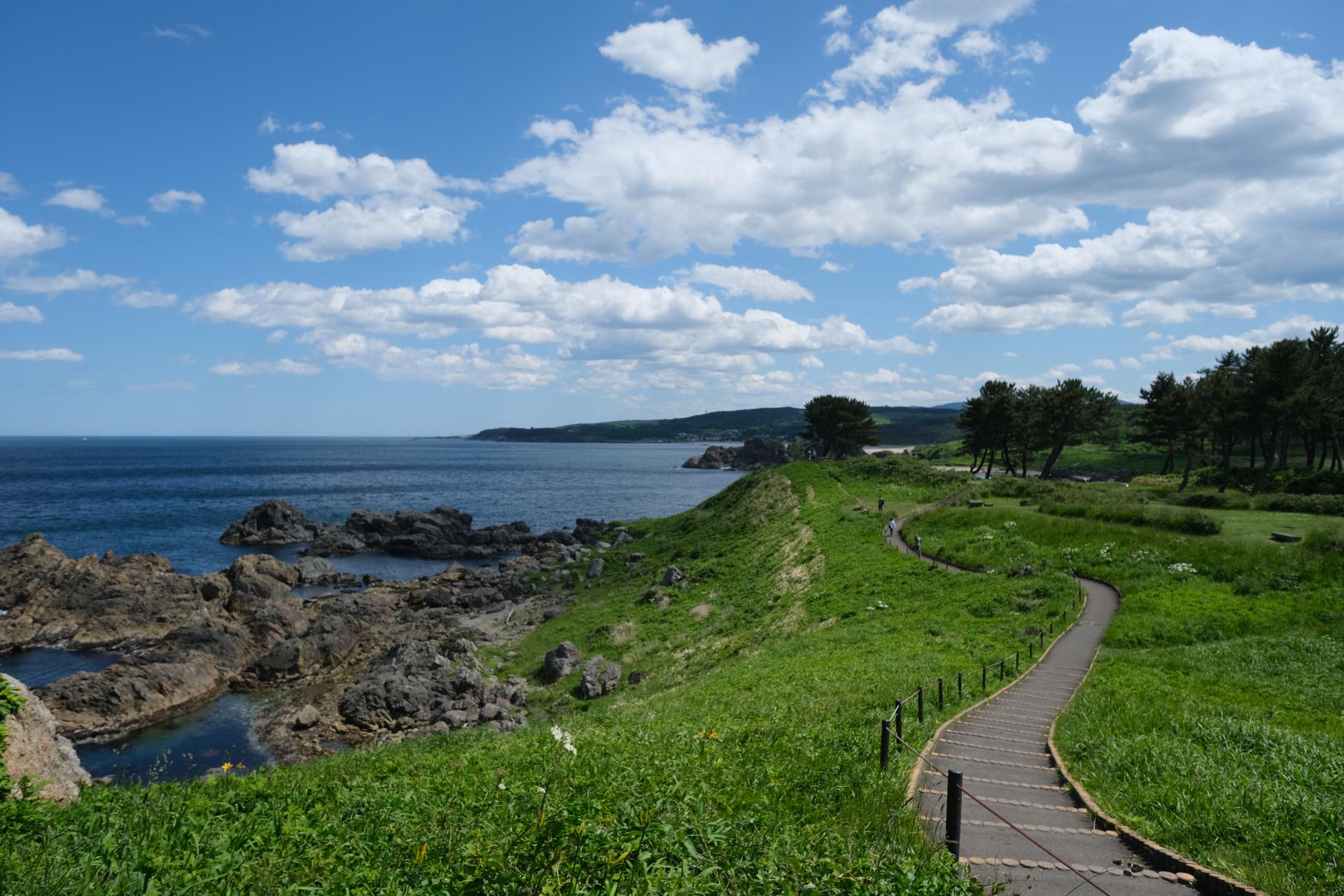
Take in the ever-changing scenery.
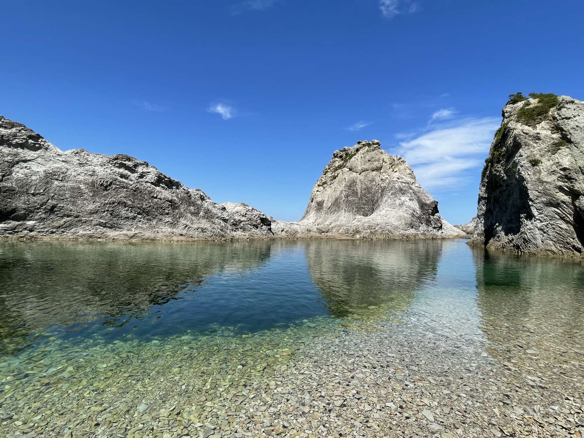
After leaving Ashigezaki Observatory, you'll walk through a varied landscape of meadows, sandy beaches, rocky areas, pine forests, and natural grasslands, completely changing in landscape every 30 minutes as you go.
The white sands of Osuka Beach are nicknamed "singing sands" because of the squeaky noise they make when stepped on. This sound is caused by the vibration of the quartz grains rubbing against each other. The pure and beautiful sands are seen as a testament to the lack of impurities.

The 3-km stretch of pine forest after this is called Yodo-no Matsubara. Here, you can glimpse the ocean between trees that are over 100 years old. Most of the trees here are Black Pines, which were planted for wind protection and to attract schools of fish.
The Tanesashi Natural Lawn, overlooks the Pacific Ocean below while remaining a part of Myo-no Maki, a pasture for horse rearing. The southern region of Aomori Prefecture, to which Tanesashi Coast belongs, has been known since ancient times as a horse-producing region. It is believed that grazing continued here until around 1965. This distinctive landscape is born of the region’s eclectic local culture.

Details of Tanesashi Natural Lawn
- Name in Japanese
- 種差天然芝生地
- Postal Code
- 031-0841
- Address
- Tanakubo, Samemachi, Hachinohe City, Aomori
- Telephone
- 0178-51-8500 (Tanesashi Coast Information Center)
- Access
- A 3-minute walk from the JR Hachinohe Line's Tanesashi-Kaigan station.
Recommended Pre-Night Stay If Walking the Hachinohe City Route!
If you're heading to Hachinohe City, the central city of the southern region, it's recommended to stay the night before and explore the town at night. There are eight alleys where you can enjoy local good eats, sake, and interact with the locals there.


Details of Western Liquor Café Prince
- Name in Japanese
- 洋酒喫茶プリンス
- Postal Code
- 031-0089
- Address
- 18 Naga-Yokocho, Hachinohe City, Aomori
- Telephone
- 0178-44-1827
- Closed
- Open every day
- Hours
- 5:00pm to midnight
- Access
- 12-minute walk from Hon-Hachinohe station on the JR Hachinohe Line.
Wake up early the next day and head to the area around JR Mutsu-Minato station.
There are bustling spots in the morning just waiting for you to find, like Tatehana Wharf Morning Market (every Sunday from mid-March to December), Mutsu-Minato Station Front Morning Market (closed on Sundays), and Hachinohe City Fish and Vegetable Retail Market (closed on Sundays and the second Saturday). Just steps away you’ll also find Hachinohe Brewery, known for its local sake labels Mutsu-Oyama and Mutsu-Hassen. These and other seasonal sake are available to taste on a tour so be sure to swing by.


Details of Hachinohe Brewery
- Name in Japanese
- 八戸酒造
- Postal Code
- 031-0812
- Address
- 9 Honcho, Minatocho, Hachinohe City, Aomori
- Telephone
- 0178-33-1171
- Closed
- (Brewery tour) Saturdays and Sundays (Saturdays also open during winter)
- Hours
- (Brewery tour) 10:00am to 4:00pm
- Access
- 5-minute walk from JR Hachinohe Line Mutsu-Minato Station
- Official Website
- Official Website (Japanese)
Plan 2: Learn the traditions of the land living with the sea – Fudai Village to Tano-Hata Village Route
(Overnight 2-day trip)
Starting from the Sanriku Railway Fudai station, a mere overnight trip can bring you to the forefront of knowing the history and culture of a land that has coexisted with the sea.
To get to Fudai station, take a 37-minute ride on the Sanriku Railway Rias Line from Kuji station. To get to Kuji station, it's 2 hours and 3 minutes on the JR Hachinohe Line from Hachinohe station, or 1 hour and 12 minutes from Tanesashi-Kaigan station, which is close to the goal of Plan 1. From Morioka Station on the Tohoku Shinkansen, it's a 2-hour and 3-minute trip on the rapid bus "Kuji Kohaku".

Day1
A shopping street protected by a floodgate
Your day kicks off with a visit to Abbey Road Shopping Street, located just a 5-minute walk from Fudai station. Many townscapes in the Sanriku region havelost their former appearance due to the tsunami caused by the Great East Japan Earthquake. However, the pre-disaster landscape still remains in Abbey Road Shopping Street, Fudai Village's central urban area, where butcher shops, confectionaries, and fresh fish stores line the street.


Why was the landscape of Fudai Village preserved? The district survived because of the lessons taught by previous tsunami waves during the Meiji and Showa eras. Just a 15-minute walk from the shopping street sits the Fudai Floodgate and Otanabe Tsunami Wall. The floodgate was completed in 1984. The then village head, Yukitoku Wamura, prioritized disaster prevention over economic measures, drawing from the experience of the Showa era tsunami where 439 people perished, and built a 15.5-meter floodgate on the Fudai River. Walking from the shopping street to the floodgate, you'll truly feel how the distance between the sea, the floodgate, and the town prevented large-scale flooding in the village center and saved many lives.

Details of Fudai Floodgate
- Name in Japanese
- 普代水門
- Postal Code
- 028-8331
- Address
- Village Section 14, Fudaimura, Shimoheigun, Iwate
- Telephone
- 0194-35-2115 (Fudai Village Tourism Promotion Office)
- Access
- 15-minute walk from Sanriku Railway Rias Line Fudai station.
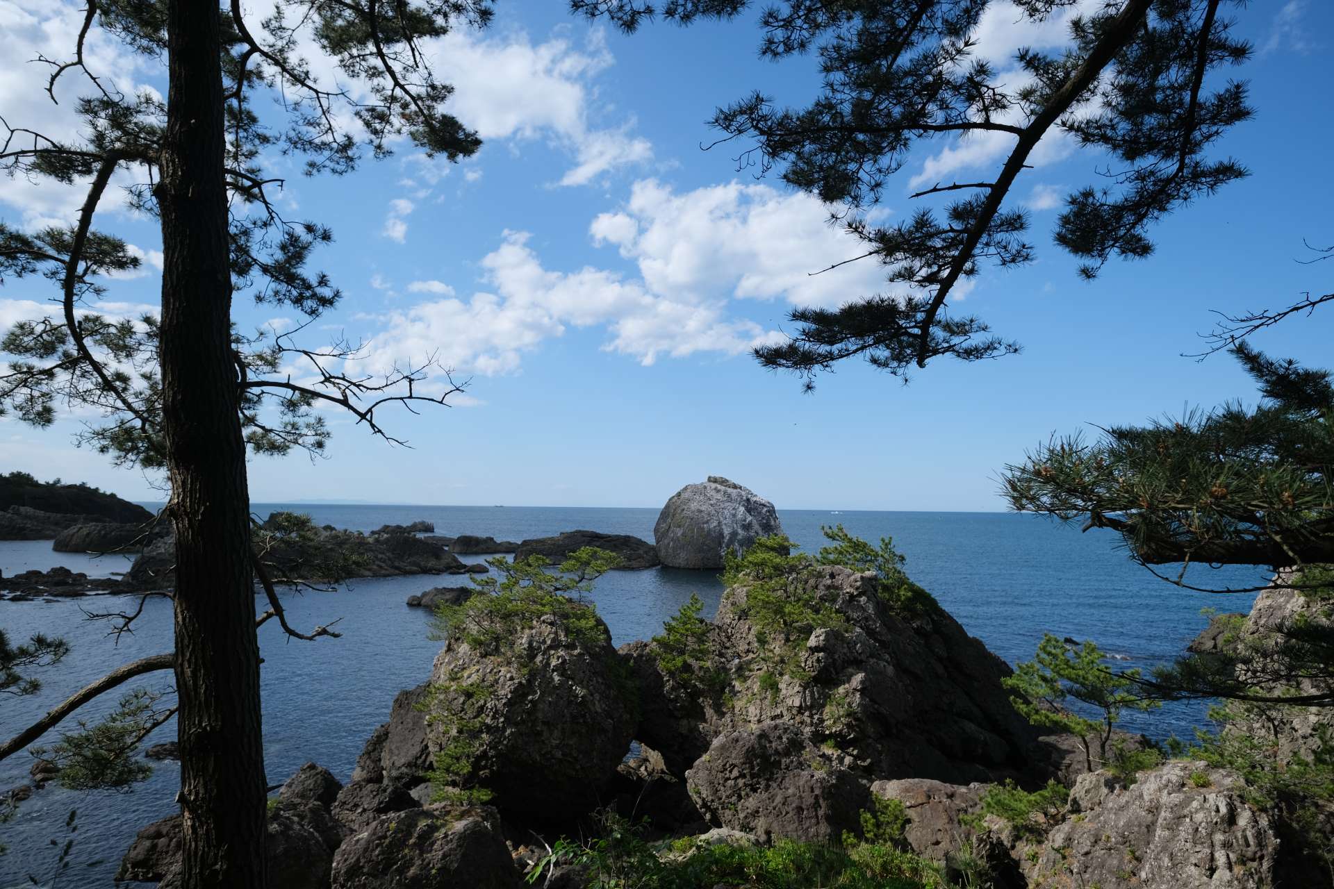
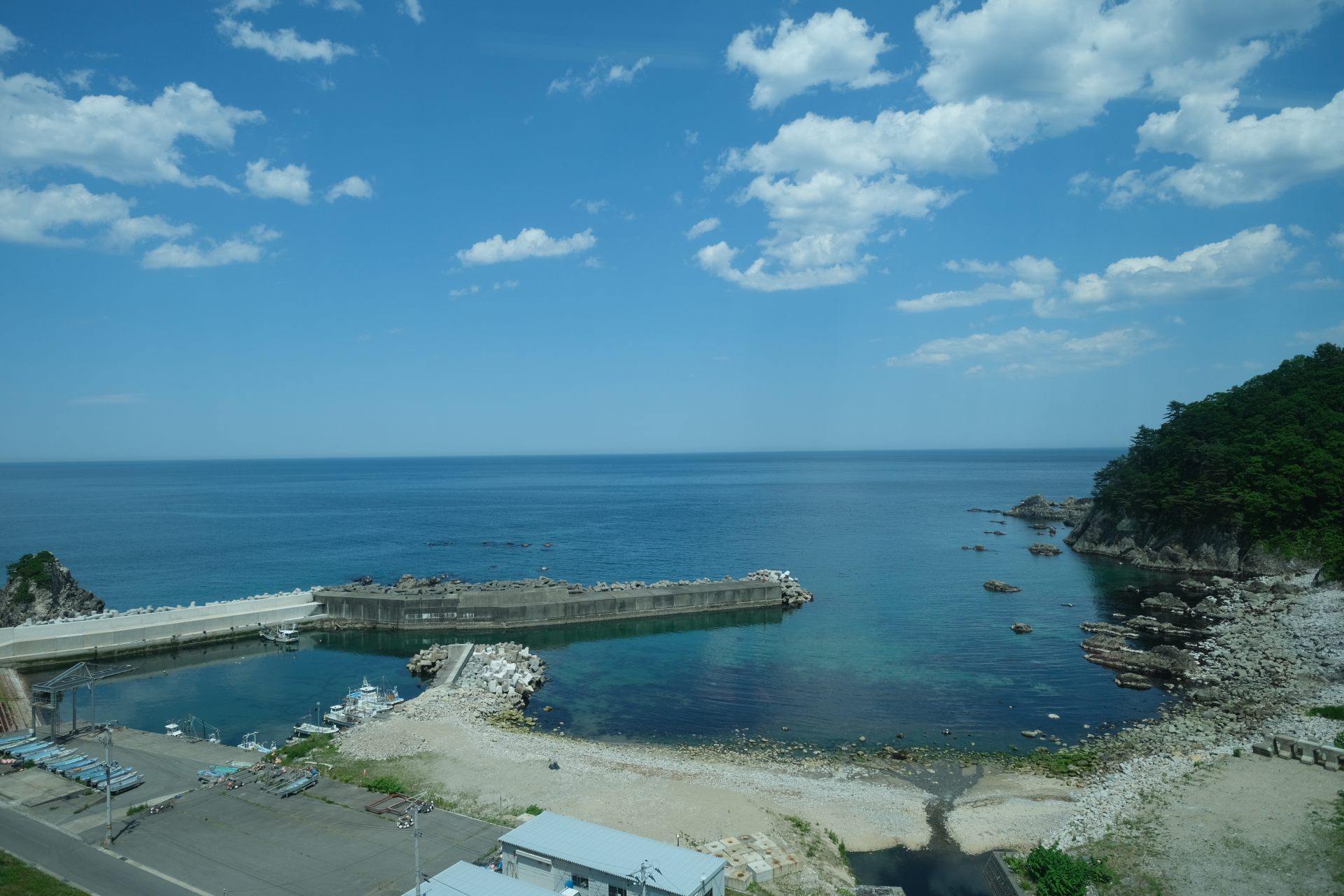
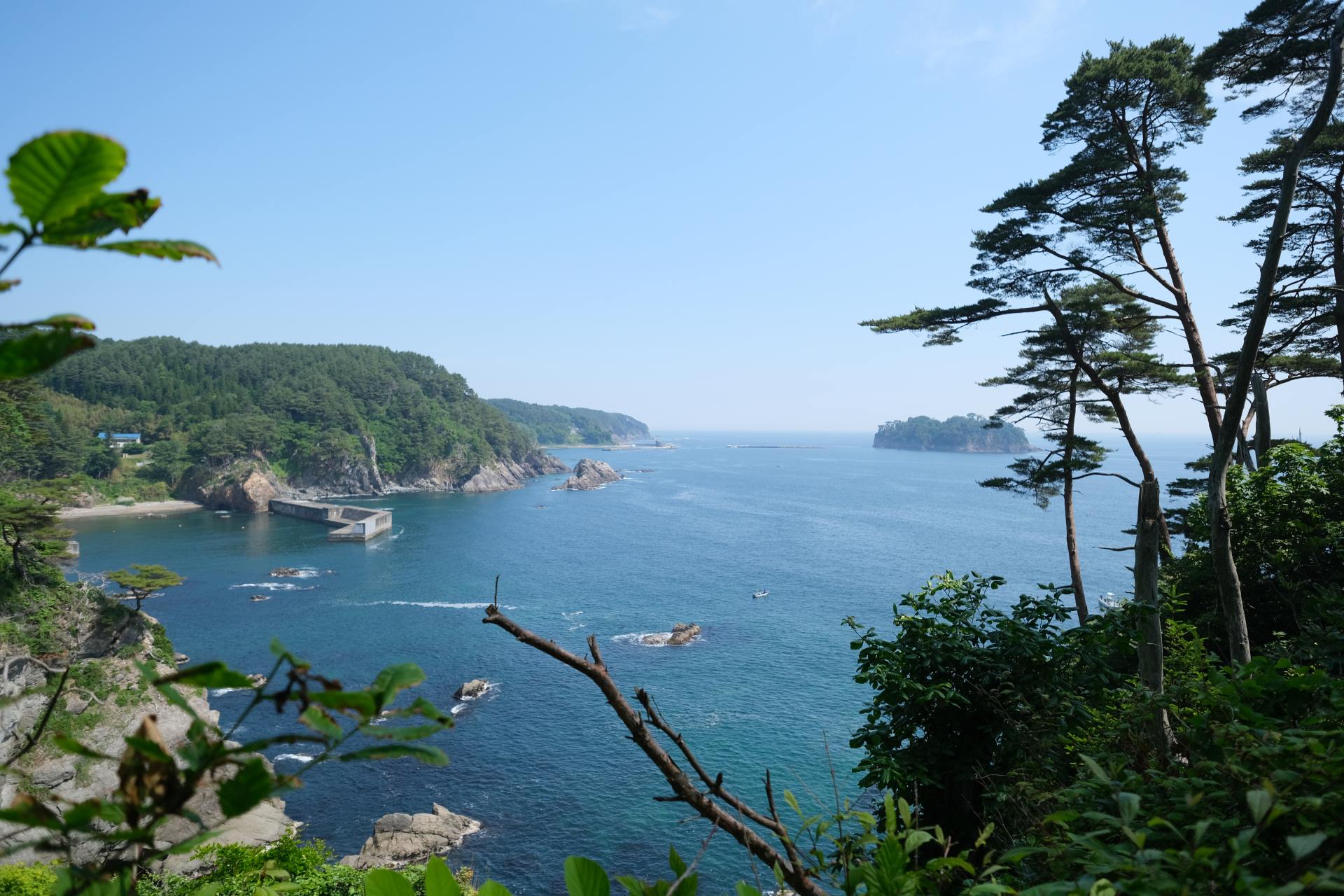
Despite the constant threat of tsunami, the people of Fudai have chosen to stay in this land and live alongside the sea. If you proceed approximately 5.7 km from the Fudai Floodgate to the Kurosaki Observation Point or lodging Kokumin Shukusha Kurosaki-so, you'll be reminded firsthand of the land's richness – a testament to the beauty of the sea and its bounties. Passing through places like Fudai Beach Park Kiraumi, Otanabe Fishing Port, and Kurosaki Fishing Port, the route called Nedari Beach Nature Walk runs beside the rugged rock formations by the sea, offering stunning views of the clear ocean.


Experience the Nationally Designated Important Intangible Folk Cultural Property: The Unotori Kagura
To top off the day, this course may even lead to the chance to experience a divine ritual said to watch over the villagers. A visit to Fudai Village will bring you to Unotori Shrine, which answers the prayers for maritime safety and a good catch. This is the home of Unotori Kagura, a processional dance and heritage folk performance in which the spirit of the shrine is said to be embodied in the lion's head as it visits across the many coastal settlements. This tradition, called Mawari Kagura, is a processional folk dance that is regarded as a distinctive element of Sanriku culture and designated as a Nationally Important Intangible Folk Cultural Property. The sounds and rhythms are ingrained in the minds of the locals since their childhood. The presence of the divine impresses on the air. As you witness such a precious artifact of culture passed down through many generations, a sense of reverence can’t be helped while thinking of the deep roots here between land and sea. Guests staying at Kokumin Shukusha Kurosaki-so can request a viewing by making an advance reservation so be sure not to miss the rare chance.


Day2
To the Main Shrine of Unotori Shrine
After staying the night at Kokumin Shukusha Kurosaki-so, visiting the main shrine of Unotori Shrine the next morning allows you to feel the more profound and solemn power of the spirits and nature. From the distant worship hall on the right of the torii gate to the main shrine located at the 424m summit of Ushitoriyama Mountain, it's about a 30-minute walk. Along the approach, you'll find sacred spots treasured by the locals over generations, such as the fortune-telling place "Oyori Place" and the "Married Cedar Trees," widely revered as gods of marriage.


Details of Unotori Shrine
- Name in Japanese
- 鵜鳥神社
- Postal Code
- 028-8362
- Address
- 13 Unedori, 25th District, Fudaimura, Shimoheigun, Iwate
- Telephone
- 0194-35-2339
- Access
- 10 minutes by taxi from Fudai station on the Sanriku Railway Rias Line.
After completing the visit, return to Kokumin Shukusha Kurosaki-so, before setting off on a 9.3 km walk to Kitayamazaki Observation Point. As you make your way through the forest atop the sheer, enormous cliffs known as the Alps of the Sea, the sense of proximity with the mountains, sea and isolated villages will begin to draw in. The distinctive landscape whispers hints of how the customs and unique culture were nurtured here for so long.


Details of Kitayamazaki Observation Deck
- Name in Japanese
- 北山崎展望台
- Postal Code
- 028-8402
- Address
- 129-10 Kitayama, Tanohatamura, Shimoheigun, Iwate
- Telephone
- 0194-33-3248 (Tanohata Village Comprehensive Tourist Information Center)
- Access
- 20 minutes by taxi from Tanohata station on the Sanriku Railway Rias Line
Cruise along the Cliffs from the Sea!
After walking to the Kitayamazaki Observation Point and taking a break in the area, you won’t want to miss trying your hands at Sappa Boat Adventures. Hop on a small boat used for sea urchin, abalone, and seaweed fishing, and embark on an approximately one-hour tour where local fishermen guide you through the unique landscapes of cliffs, strange rocks, and more. This is a special experience where you get to look back and view the trail from a new angle over the seas.


Details of Sappa Boat Adventures
- Name in Japanese
- サッパ船アドベンチャーズ
- Postal Code
- 028-8402
- Address
- 142-3 Tsukue, Tanohatamura, Shimoheigun, Iwate
- Telephone
- 0194-37-1211 (NPO Experience Village & Tanohata Network)
- Closed
- Alternative programs are available in bad weather.
- Hours
- Please inquire.
- Access
- 10 minutes by taxi from Tanohata station on the Sanriku Railway Rias Line.
Make the Most of Sanriku Railway
The Sanriku Railway connects the Sanriku coast, linking Kuji Station and Mori Station and is known for its beautiful scenic views. Especially between Rikuchu-Noda Station and Fudai Station, there are picture-perfect spots to snap like Osawa Bridge with its stunning sea view and Akkagawa Bridge, where you can witness salmon swimming upstream in the fall. With the availability of special trains like lunch trains, wine trains, special design-wrapped trains, and more, this is one spot that makes for an easy Sanriku sightseeing add-on along the trail. Tanohata station is about a one-hour walk from Tsukue Beach.

Plan 3: Revel in the Local Arts Nurtured by the Forest and Sea: Miyako to Otsuchi Route
(1 day + Local Otsuchi Town Performance of Kagari Fire Dance)
Iwate Prefecture is often called a "treasure trove of local performing arts." If you want a mini-expedition in authentic, cultural heritages and traditional folk arts passed down along the Sanriku coast, the Miyako to Otsuchi route is the way to go.

Lost in the thrills of the tiger dance!
A visit to Otsuchi will bring you frontstage and center to the artful vigor of the tiger dance, performed amid the mystical ambiance of bonfires. There’s a shuttle bus to the venue, Kozuchi Shrine, from Sanriku Hana Hotel Hamagiku, situated along the Michinoku Coastal Trail.


During the Edo period, a wealthy merchant from the area named Zenbei Maekawa (also known as Kirikiri Zenbei), transported the many sea goods of Sanriku to Edo. The Otsuchi Tiger Dance hails from the sailors of his transport ships, who were so impressed by a scene from the popular puppet theater play Kokusenya Kassen in Edo that they re-enacted it as dance upon return.
While the town suffered a tragic loss of over 1,200 people to death or missing after the Great East Japan Earthquake, the dance continues as a dedication to deities, a gratitude for support, and an encouragement to victims of natural disasters that still occur frequently.
Details of Kozuchi Shrine
- Name in Japanese
- 小鎚神社
- Postal Code
- 028-1115
- Address
- 2-16 Kamicho, Otsuchicho, Kamiheigun, Iwate
- Telephone
- 0193-42-3284
- Hours
- Open for worship (office hours 9:00am - 5:00pm).
- Access
- 8-minute walk from Otsuchi station on the Sanriku Railway Rias Line. During the "Sanriku Otsuchi Traditional Kagari Fire Dance", lodging facilities in the town offer pick-up services exclusively for their guests.
- Note
- The date and exact programming for the Sanriku Otsuchi Traditional Kagari Fire Dance differ each year. For details, please check the official website of the Otsuchi Tourism Exchange Association.
Savoring the Local Arts and Culinary Traditions Shaped by the Terrain
In Sanriku, the "Sanriku International Arts Festival" is also held after the Great East Japan Earthquake. Walking the Michinoku Coastal Trail, it becomes clear why so many diverse local arts survive here: remote mountain settlements and challenging terrains that isolated communities.
As introduced in Plan 2, characterized by Kitayamazaki, the area north of Miyako City is notable for its cliffs, or marine terraces, formed by uplifted strata from the sea. On the other hand, the area south of Miyako City features a complex ria coastline with long courses that meander across peninsulas.
The latter course, leading all the way to Otsuchi Town, is more suited for advanced hikers. However, with the smart use of the Sanriku Railway, even beginners can comfortably walk the trail in central Miyako City and enjoy the tiger dance performance.
The trail starting from Kyukamura Rikuchu Miyako, which offers shuttle services from JR/Sanriku Railway's Miyako station, allows hikers to traverse around 7 km, including ascends and descends, to Jodogahama in half a day.
From the Jodogahama Visitor Center, it's a 15-minute bus ride to Miyako station. From there, you can access the Namiitakaigan station near Sanriku Hana Hotel Hamagiku or the Otsuchi station near Kozuchi Shrine via the Sanriku Railway Rias Line.


The vegetation varies between the southern Miyako City and Otsuchi Town. South is predominantly evergreen trees, while the north has many deciduous trees that conserve energy by shedding leaves in winter. The nutrients from the fallen leaves flow through streams into the nearby sea. This proximity of mountains to the sea nurtures the rich fishing grounds of Sanriku, a realization that becomes palpable when walking.


Take Along the Hiking Map Book and Hiking Passport
When embarking on the Michinoku Coastal Trail, we recommend using the "Hiking Map Book" available at online shops and visitor centers. A portion of the sales goes to the trail's upkeep. It was created with the hope of revitalizing the northeastern, or “Tohoku” coast, aiming for those who walk it and the communities that surround it to nurture the path together.


Conclusion
Thus concludes your trek across the Michinoku Coastal Trail, home to a long-stayed tradition of living in harmony with the land and sea. The walk itself will bring you to the front step of this area’s undeniably deep culture and enthralling heritage.
With distinctive coastlines and landscapes, tales from the Heian and Edo periods, and narratives spun after the Great East Japan Earthquake... Take to the trail and get lost on a journey unlike any other, all while unlocking the hidden mystique of northeast Japan.
If you're interested in walking the Michinoku Coastal Trail, seeking information, or planning your trip, please contact the "Michinoku Coastal Trail Natori Trail Center".
(e-mail: info@m-tc.org | Phone: 022-398-6181 | Managed by: NPO Michinoku Trail Club)
・Online Store
・NPO Michinoku Trail Club
・Hiking Passport