生氣蓬勃的自然風光吸引了眾多旅人來這兒~

Verified [Verified] denotes information that has been published with confirmation of its owing parties.
Cape Kamui
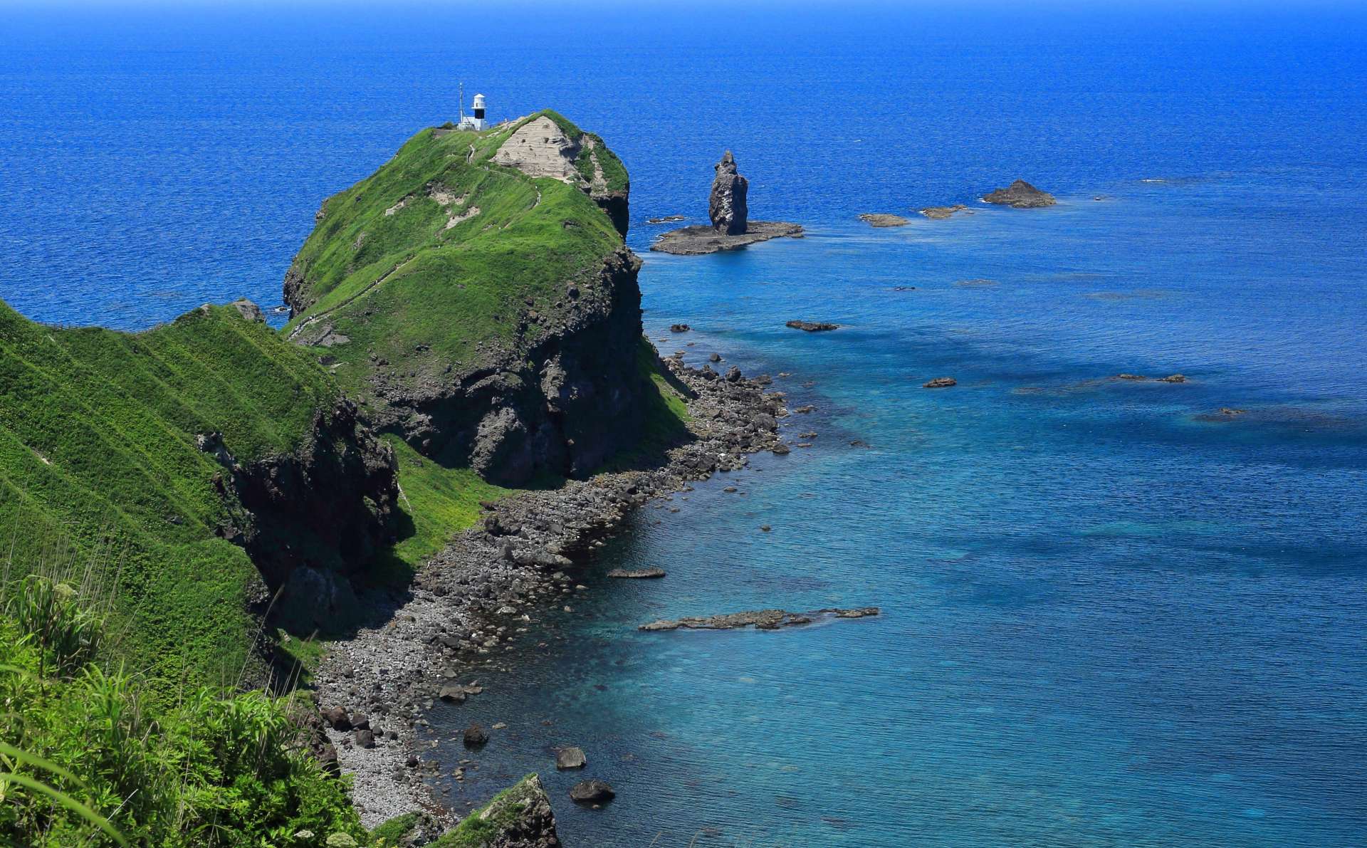
A stunning cape surrounded by the clear, azure waters known as "Shakotan Blue."
Located within the Niseko-Shakotan-Otaru Kaigan Quasi-National Park, this cape stretches out from the northwestern part of the Shakotan Peninsula into the Sea of Japan. It's approximately 770 meters from the parking lot to the tip of the cape, with a scenic 20-minute walk along a trail that has some ups and downs. The natural beauty of the surrounding area and the clear, azure waters known as "Shakotan Blue" make the journey truly breathtaking. At the tip of the cape, you can find the Kamui Rock and the Cape Kamui Lighthouse, offering a 300-degree rounded horizon view.
The Kamui Rock has a legend associated with it. It's said to have formed when Charenka, a chief's daughter from the Hidaka region who adored Minamoto no Yoshitsune, threw herself into the sea in pursuit of him. After this, any ship with a woman onboard that approached the rock would capsize. As a result, women were prohibited from entering the area up until the early Meiji era. The gate at the trailhead is called "The Forbidden Gate for Women," a remnant from that period, and the trail is named "Charenka's Path."
Along the trail, seasonal flowers like Ezo Fuuro, Ezo Kanzou, and Rosa rugosa bloom.
Highlights
-
A cape located within the Niseko-Shakotan-Otaru Kaigan Quasi-National Park.
-
Renowned for its beautiful "Shakotan Blue" waters and magnificent views.
-
Offers a 300-degree panoramic view from its tip.
-
The trail may be closed due to weather conditions.
-
Due to the trail's undulating terrain, it's recommended to wear comfortable walking shoes.
Photos
-
![Walk the approximately 770m trail to reach the cape's tip.]()
Walk the approximately 770m trail to reach the cape's tip.
-
![The towering Kamui Rock stands at about 40m tall by the sea.]()
The towering Kamui Rock stands at about 40m tall by the sea.
-
![The clear, azure waters known as "Shakotan Blue."]()
The clear, azure waters known as "Shakotan Blue."
-
![Located within the nature-rich Niseko-Shakotan-Otaru Kaigan Quasi-National Park.]()
Located within the nature-rich Niseko-Shakotan-Otaru Kaigan Quasi-National Park.
-
![In early summer, Ezo Kanzou blooms brilliantly.]()
In early summer, Ezo Kanzou blooms brilliantly.
-
![The sight of the sunset sinking into the horizon is a must-see.]()
The sight of the sunset sinking into the horizon is a must-see.
Official FAQs
Frequently Asked Questions have been vetted and answered directly by each listing.
Q
Do you have signs or pamphlets in foreign languages? (If you do, which languages are available?)
We do not have foreign language pamphlets. However, we do have information signs available in English, Traditional Chinese, and Simplified Chinese.
Q
Is free Wi-Fi available in the area?
No free Wi-Fi available.
Q
Are coin lockers available?
Not available.
Q
Are there restrooms available?
No, there are not.
Reviews
-
Andy Huang
Details
- Name in Japanese
- 神威岬
- Postal Code
- 046-0321
- Address
- Kozakicho, Shakotancho, Shakotangun, Hokkaido
- Telephone
- 0135-44-3715(Shakotan Tourism Association)
- Closed
- Trail road:Winter season(Around November to mid-April)
- Business Hours
- Trail road: Opening and closing times vary based on season and weather.
- Admission
- Free
- Access
-
From JR Yoichi Station, take the bus to "Shakotan Cape Kamui" (about 1 hour 50 minutes). The cape is a short walk from the bus stop.
Note: The bus operates from late April to late October. - Official Website
- Official Website (Japanese)


